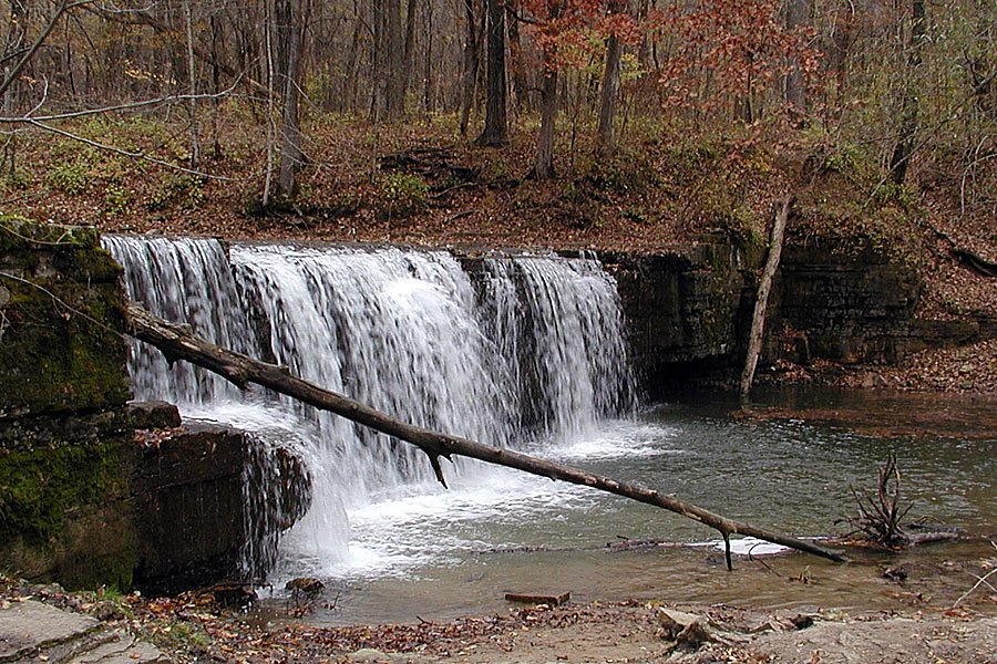
Step into the heart of Minnesota's vanishing Big Woods at these peaceful walk-in campsites, where towering maples and oaks replace the hum of RV generators. After parking in a central lot, you'll carry your gear a short distance into the forest—a small trade for the reward of waking to birdsong and falling asleep under a canopy of centuries-old hardwoods, all while staying close to Hidden Falls and the park's excellent trail network.
Walk‑in campsites use a central parking area rather than adjacent vehicle parking; the park also offers drive‑in campsites elsewhere.
Historical Significance
The park preserves a remnant of the historic Big Woods ecosystem that once covered much of south-central Minnesota, providing conservation value for this disappearing forest type.Weather and SeasonsTime your visit for late April through May to witness the forest floor's legendary wildflower display, or come in early fall when the hardwood canopy erupts in gold and crimson. Summer offers cool, shaded camping beneath the forest canopy, while spring and fall shoulder seasons promise solitude for those who don't mind cooler nights. Winter camping is possible but limited—contact the park to confirm seasonal access and available services before planning a cold-weather adventure.
Weather data by Open-Meteo.com, licensed under CC BY 4.0, processed by Outdoorithm.
Natural Features and SceneryYour tent will be nestled within one of southern Minnesota's last remaining stands of Big Woods—a cathedral of mature maple, basswood, and oak that once blanketed the region. The gently rolling forest floor comes alive each spring with carpets of wildflowers rarely seen elsewhere, while shaded trails lead you through creek corridors to Hidden Falls, where Prairie Creek tumbles over a limestone ledge into a perfect spot for wading on warm afternoons. This is the forest as early settlers found it: dense, diverse, and utterly enchanting.
Geological RegionSouthern Minnesota "Big Woods" hardwood forest; Prairie Creek with a low limestone ledge (Hidden Falls)
Scenic ViewsIntimate forest canopy views, ferny understory and creek corridors; photogenic angles at Hidden Falls and notable hardwood fall color within the campground and on nearby trails.
 0
0