Go if
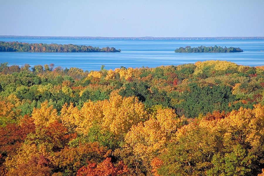
Fall campers chasing loon calls and autumn color get the best version of this place, with reduced insects and good hiking on the park's 3-mile trail network. Pack your own water and toilet paper since the pump is unreliable.
 3.9328 reviews
Price
Varies
Booking
Reservable
Sites
Varies
Season
Year-round
Cell
No Service
Pets
Pets Allowed
Price
Varies
Booking
Reservable
Sites
Varies
Season
Year-round
Cell
No Service
Pets
Pets Allowed
We'll monitor this campground and alert you the moment sites become available.
Free to start · Premium adds 2-min scans
263,000+ sites monitored · Email alerts to start; SMS and in-app with an account
Learn more about alerts →Ogechie Campground
Isle, Minnesota (no street address found)
We'll monitor this campground and alert you the moment sites become available.
Free to start · Premium adds 2-min scans
263,000+ sites monitored · Email alerts to start; SMS and in-app with an account
Learn more about alerts →Fall campers chasing loon calls and autumn color get the best version of this place, with reduced insects and good hiking on the park's 3-mile trail network. Pack your own water and toilet paper since the pump is unreliable.
No showers and a notoriously unreliable water source are permanent realities here. July visitors in particular report being overwhelmed by mosquitoes and black flies even with repellent, and sites 23 and 7 draw complaints for outhouse proximity.
Context for the broader area surrounding Ogechie Campground, sourced from the federal Recreation.gov rec-area record.
Arrowrock Reservoir is formed by <A HREF="http://www.usbr.gov/projects/Facility.jsp?fac_Name=Arrowrock+Dam">Arrowrock Dam</a> which is part of the <A HREF="http://www.usbr.gov/projects/Project.jsp?proj_Name=Boise%20Project">Boise Project</a>. The Reservoir is managed by the <A HREF="http://fs.usda.gov/wps/portal/!ut/p/_s.7_0_A/7_0_RU4?ss=110402&navtype=forestBean&navid=091000000000000&pnavid=null&cid=null&ttype=main&pname=Boise%20National%20Forest%20-%20Home">Boise National Forest,</a> (<A HREF="http://www.fs.fed.us/r4/boise/map.html">Boise National Forest map</a>). This 18 mile narrow canyon reservoir of 3,150-acres has limited access to 60 miles of shoreline. Boating, canoeing, windsurfing, and fishing are the major recreation activities at Arrowrock, located east of Boise. The reservoir is only 30 minutes from Boise and provides access to the city's nearest national forest. Fish species include rainbow trout, kokanee, yellow perch, whitefish, and the protected bull trout. Season open year-round. Reservoir acre feet and total reservoir capacity and cubic feet/second release rates for rivers below <A HREF="http://www.usbr.gov/pn/hydromet/boipaytea.cfm">Boise & Payette River Basins</a> reservoirs and select river locations are updated daily and graphically provided. Site offers: vault toilets, boat ramps and dock, parking, and dispersed camping.
Follow Idaho 21 to Mores Creek Bridge, about 18 miles, then take the road to the right to Arrowrock Dam.
Ogechie Campground appears in our curated guides. Explore more top-rated campgrounds for the same activities and regions.

Availability, what to pack, similar spots — ask anything and get an instant answer.
Summer daytime highs run 70–85°F and the park's full roster of ranger programs and lake activities makes it the most popular season. The tradeoff is severe mosquitoes and biting flies, especially during July. Reviewers consistently mention needing bug spray, hooded jackets, and long sleeves even with repellent. Fall visits reduce insect pressure and add autumn color to the forest canopy. The campground operates seasonally, so confirm open dates with the park before booking shoulder-season trips.
Forest setting likely favorable for fall foliage and quieter visits, though specific reports are limited.
Weather data by Open-Meteo.com, licensed under CC BY 4.0, processed by Outdoorithm.
Reservation tips, booking windows, and free cancellation alerts.
Reviewers and park information describe pit/vault toilets, food lockers, and gravel tent pads. There are no showers; a solar-powered water pump may exist but has been reported as unreliable, so campers are advised to bring their own water and toilet paper.
Researching this campground? Ask anything — other campers and our team will weigh in. No visit required.
Short heads-ups about the road in, gear quirks, and timing, compiled by Outdoorithm from public reviews and operator information.
Rate Ogechie Campground
Been here? Tap a star to start. Takes about a minute.
Sign-in required only if you want your name on it.

Be the first to review this campground
Every adventure creates another. Share what you learned so the next camper feels a little more prepared heading out.