Go if
Fall backpackers who want genuine solitude close to real trail mileage. The fire tower hike with Mille Lacs views is the standout payoff, and reviewers consistently call these sites well-spaced and private compared to the main campground loop.
 04 reviews
Price
Varies
Booking
Reservable
Sites
4 campsites
Season
Year-round
Cell
No Service
Pets
No Pets
Price
Varies
Booking
Reservable
Sites
4 campsites
Season
Year-round
Cell
No Service
Pets
No Pets
We'll monitor this campground and alert you the moment sites become available.
Free to start · paid plans add 2-min scans
263,000+ sites monitored · Email alerts to start; SMS and in-app with an account
Learn more about alerts →Backpack Campsites
46.1259, -93.7040
We'll monitor this campground and alert you the moment sites become available.
Free to start · paid plans add 2-min scans
263,000+ sites monitored · Email alerts to start; SMS and in-app with an account
Learn more about alerts →Fall backpackers who want genuine solitude close to real trail mileage. The fire tower hike with Mille Lacs views is the standout payoff, and reviewers consistently call these sites well-spaced and private compared to the main campground loop.
Summer visits without serious bug prep will be rough, deer flies are persistent in the warm-weather woods. No showers at the sites, potable water requires a fill-up at park spigots before you hike in, and cell coverage is unreliable at best.
Context for the broader area surrounding Backpack Campsites, sourced from the federal Recreation.gov rec-area record.
Arrowrock Reservoir is formed by <A HREF="http://www.usbr.gov/projects/Facility.jsp?fac_Name=Arrowrock+Dam">Arrowrock Dam</a> which is part of the <A HREF="http://www.usbr.gov/projects/Project.jsp?proj_Name=Boise%20Project">Boise Project</a>. The Reservoir is managed by the <A HREF="http://fs.usda.gov/wps/portal/!ut/p/_s.7_0_A/7_0_RU4?ss=110402&navtype=forestBean&navid=091000000000000&pnavid=null&cid=null&ttype=main&pname=Boise%20National%20Forest%20-%20Home">Boise National Forest,</a> (<A HREF="http://www.fs.fed.us/r4/boise/map.html">Boise National Forest map</a>). This 18 mile narrow canyon reservoir of 3,150-acres has limited access to 60 miles of shoreline. Boating, canoeing, windsurfing, and fishing are the major recreation activities at Arrowrock, located east of Boise. The reservoir is only 30 minutes from Boise and provides access to the city's nearest national forest. Fish species include rainbow trout, kokanee, yellow perch, whitefish, and the protected bull trout. Season open year-round. Reservoir acre feet and total reservoir capacity and cubic feet/second release rates for rivers below <A HREF="http://www.usbr.gov/pn/hydromet/boipaytea.cfm">Boise & Payette River Basins</a> reservoirs and select river locations are updated daily and graphically provided. Site offers: vault toilets, boat ramps and dock, parking, and dispersed camping.
Follow Idaho 21 to Mores Creek Bridge, about 18 miles, then take the road to the right to Arrowrock Dam.
Backpack Campsites appears in our curated guides. Explore more top-rated campgrounds for the same activities and regions.

Availability, what to pack, similar spots — ask anything and get an instant answer.
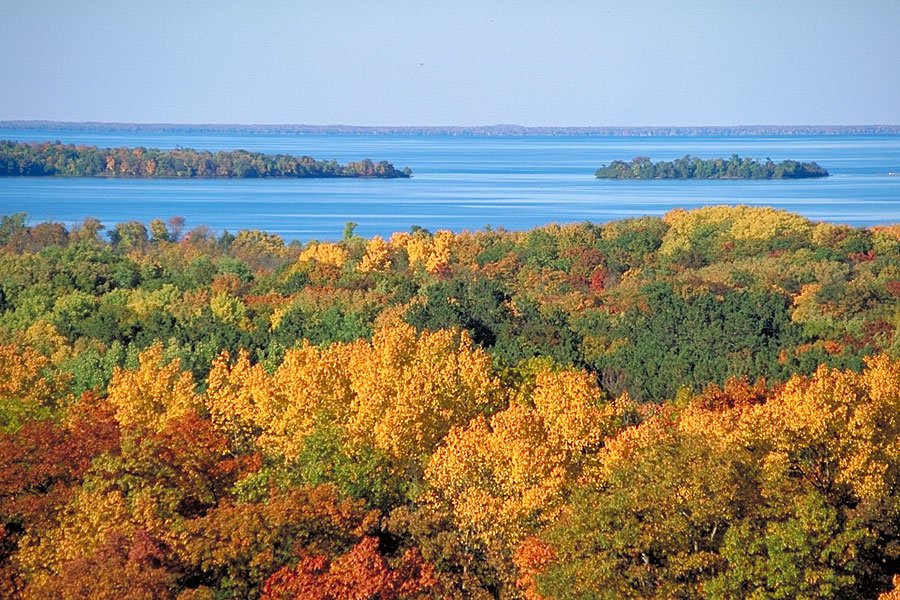
Plan your visit between late spring and early fall for the most comfortable conditions, though hardy winter campers can potentially use these sites year-round (check with the DNR for current availability). Autumn transforms the canopy into a spectacular show of golds and crimsons, typically peaking from late September through October. Summer brings ideal weather for hiking and paddling adventures, though you'll want to pack insect repellent—deer flies can be persistent companions on warm days.
Mixed hardwoods (maple, oak) imply strong fall color season; recommended late-spring to fall window.
Weather data by Open-Meteo.com, licensed under CC BY 4.0, processed by Outdoorithm.
Reservation tips, booking windows, and free cancellation alerts.
Primitive, hike-in backpack campsites with basic campsite amenities (fire rings and vault toilets). No utility hookups or dump station; potable water is available at park spigots/trailheads but not at individual backpack sites.
Researching this campground? Ask anything — other campers and our team will weigh in. No visit required.
Short heads-ups about the road in, gear quirks, and timing, compiled by Outdoorithm from public reviews and operator information.
Rate Backpack Campsites
Been here? Tap a star to start. Takes about a minute.
Sign-in required only if you want your name on it.

Be the first to review this campground
Every adventure creates another. Share what you learned so the next camper feels a little more prepared heading out.