Go if
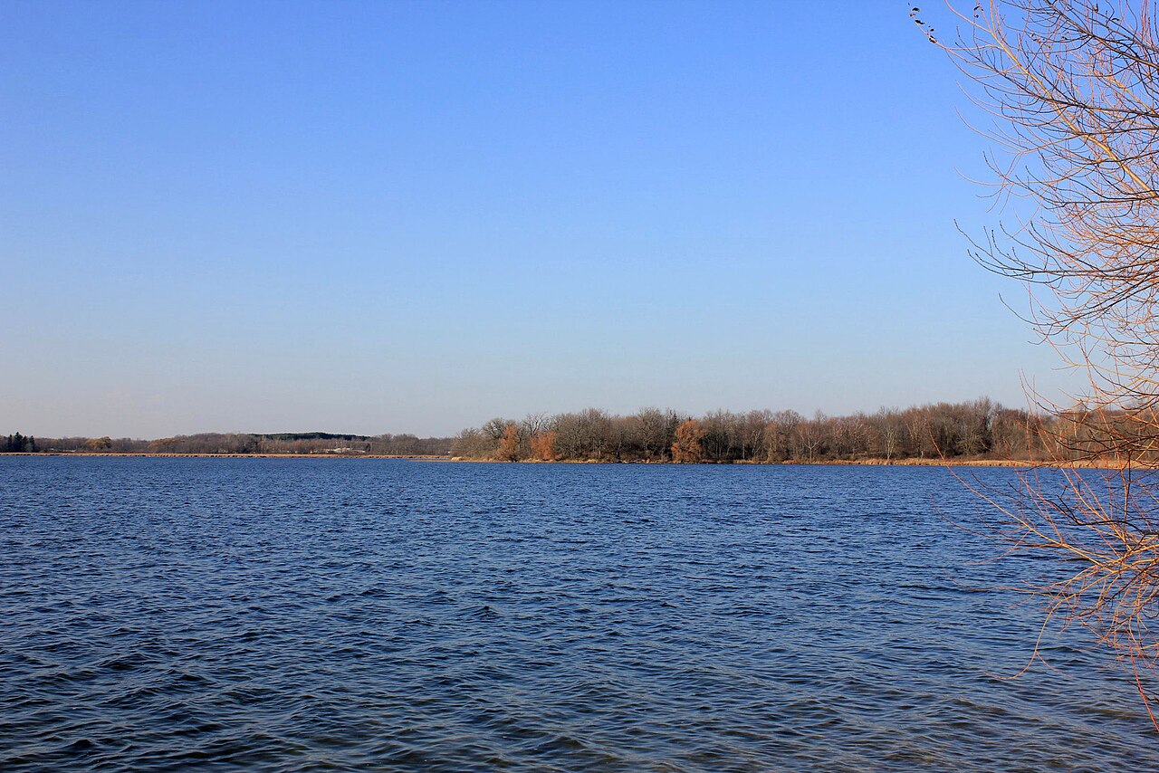
RV campers who want full hookups in Ohio without driving to a private park. The lower ring sits right on Rocky Fork Lake, launch access is easy, and the camp store staff will lend you pickleball paddles on arrival.
 4.3835 reviews
Price
Varies
Booking
Reservable
Sites
Varies
Season
During the winter ca...
Cell
No Service
Pets
No Pets
Elevation by Open-Meteo.com, licensed under CC BY 4.0, processed by Outdoorithm.
Price
Varies
Booking
Reservable
Sites
Varies
Season
During the winter ca...
Cell
No Service
Pets
No Pets
Elevation by Open-Meteo.com, licensed under CC BY 4.0, processed by Outdoorithm.
We'll monitor this campground and alert you the moment sites become available.
Free to start · Premium adds 2-min scans
263,000+ sites monitored · Email alerts to start; SMS and in-app with an account
Learn more about alerts →Rocky Fork Lower Campground
39.1858, -83.5295
We'll monitor this campground and alert you the moment sites become available.
Free to start · Premium adds 2-min scans
263,000+ sites monitored · Email alerts to start; SMS and in-app with an account
Learn more about alerts →RV campers who want full hookups in Ohio without driving to a private park. The lower ring sits right on Rocky Fork Lake, launch access is easy, and the camp store staff will lend you pickleball paddles on arrival.
Hot showers are non-negotiable for your group. Multiple reviewers report no hot water and mold in the shower houses, so call ahead to check current conditions before you commit to a stay.
Context for the broader area surrounding Rocky Fork Lower Campground, sourced from the federal Recreation.gov rec-area record.
The 5,100 acre Rough River Lake provides a wide variety of outdoor recreational opportunities. The U.S. Army Corps of Engineers, in cooperation with the Commonwealth of Kentucky, manages Rough River Lake's land and water for wildlife, fisheries, and recreation. The lake is situated in Breckinridge, Hardin, and Grayson counties in south central Kentucky. The dam is located on the Rough River near the community of Falls of Rough, about 20 miles from Leitchfield and 95 miles southwest of Louisville. Many visitors enjoy seeing the historic Green Farm nearby, consisting of about 3,000 acres, a large ancestral home, an old water-powered mill and store, and a new 18-hole golf course, Lafayette Green. The original land grant was to former Kentucky Supreme Court Justice Benjamin Sebastian, who was a co-conspirator with Aaron Burr. George Washington, who traded it for a horse, once owned part of the land.
From Louisville, KY: <br>Option 1: Begin at ramp onto I-64 West toward New Albany/St. Louis, traveling 22.3 miles. Take the IN-135 exit- Exit Number 105- toward Palmyra/Corydon, onto IN-135 South toward Corydon, traveling 16.7 miles. Continue on Bypass Road KY-79 for 2.1 miles. Turn right onto KY-79, traveling 10.1 miles. Continue on 1st Avenue, KY-79S for 495 feet. Turn a slight right onto US-60, traveling 11.8 miles. Turn left onto KY-259/KY-79, traveling 9.7 miles. Turn right to stay on KY-79, traveling 3.4 miles. Turn left to continue on KY-79, traveling 1.9 miles. End at 14957 Falls of Rough Road, Falls of Rough, KY. Distance is approximately 78 miles with an approximate travel time of 1.5 hours. <br>Option 2: Begin at ramp onto Gene Snyder Freeway KY-841W toward US-31W/US-60, traveling 5.8 miles. Take the US-31W/US-60/Fort Knox/Louisville exit-Exit Number 1-traveling .3 miles. Turn left on Dixie Highway US-31W S/ US-60W, traveling 14.8 miles. Turn right onto US-60, traveling 29.4 miles. Turn left onto KY-259/KY-79, traveling 9.7 miles. Turn right to stay on KY-79, traveling 3.4 miles. Turn left to continue on KY-79, traveling 1.9 miles. End at 14957 Falls of Rough Road, Falls of Rough, KY. Distance is approximately 65 miles with an approximate travel time of 1 hour, 20 minutes. <br>Option 3: Begin at ramp onto Gene Snyder Freeway KY-841W toward I-65, traveling 6.5 miles. Take I-65/Louisville/Nashville exit-Exit Number 10- onto I-65 S toward Nashville/Elizabethtown, traveling 34 miles. Take US-31W/KY-62/Wendell H Ford Western Kentucky Parkway/Hodgenville/Paducah exit - Exit Number 91- toward Paducah/Elizabethtown/Owensboro/Western Kentucky Parkway W, traveling 29.6 miles. Take KY-259/Leitchfield/Brownsville exit - Exit Number 107 - traveling .3 miles. Turn right onto S Main Street/KY-259, traveling .9 miles. Take 3rd exit from roundabout Courthouse Square onto W Main Street/KY-54, traveling 10.9 miles. Turn right onto Falls of Rough Road/KY-79, traveling 7.6 miles. End at 14957 Falls of Rough Road, Falls of Rough, KY. Distance is approximately 90 miles with an approximate travel time of 1.5 hours. <br>From Owensboro, KY: Begin at ramp onto Wendell H Ford Expressway/US-60 E, traveling 6.8 miles. Take KY-54/East Parrish Avenue/Owensboro/Leitchfield exit- Exit Number 18 - traveling .2 miles. Turn right onto Leitchfield Road/KY-54, traveling 29.8 miles. Turn left onto KY-110, traveling 8.2 miles. Turn left onto Falls of Rough Road/KY-79, traveling 1.8 miles. End at 14957 Falls of Rough Road, Falls of Rough, KY. Distance is approximately 46 miles with an approximate travel time of 1 hour. <br>From Bowling Green, KY: Begin at intersection of Scottsville Road/US-231 and US 31W, continue on US-31W-Bypass, traveling .6 miles. Bear left onto Lehman Avenue, traveling .3 miles. Turn left onto Fairview Avenue/KY-234, traveling .7 miles. Continue on Veterans Memorial Lane/US-68 W, traveling .3 miles. Bear right onto Gordon Avenue/KY-185, traveling 33 miles. Continue on South Main Street/KY-79, traveling 15.2 miles. End at 14957 Falls of Rough Road, Falls of Rough, KY. Distance is approximately 50 miles with an approximate travel time of 1 hour. <br>From Elizabethtown, KY: Begin at ramp onto Wendell H Ford Western Kentucky Parkway West, traveling 28.8 miles. Take KY-259/Leitchfield/Brownsville exit - Exit Number 107 - traveling .3 miles. Turn right onto S Main Street/KY-259, traveling .9 miles. Take 3rd exit from roundabout Courthouse Square onto W Main Street/KY-54, traveling 10.9 miles. Turn right onto Falls of Rough Road/KY-79, traveling 7.6 miles. End at 14957 Falls of Rough Road, Falls of Rough, KY. Distance is approximately 48 miles with an approximate travel time of 50 minutes.

Availability, what to pack, similar spots — ask anything and get an instant answer.
Summer delivers the best lake experience. Daytime highs hover around 80–85°F, lows in the low to mid-60s. Ideal for swimming, boating, and shore fishing. Full campground services and all electric hookups are running. Weekends fill up, so reserve early or arrive for walk-in sites when the store opens. Late spring and early fall offer fewer crowds and still-good weather for time on the water, though some sites can flood after heavy rain.
Seasonal notes: 'Summer delivers the best lake experience'—ideal for swimming, boating, shore fishing.
Weather data by Open-Meteo.com, licensed under CC BY 4.0, processed by Outdoorithm.
Reservation tips, booking windows, and free cancellation alerts.
A full-service campground offers electric, non-electric and full hook-up campsites suitable for trailers and tents at the northwest corner of the lake. Pets are permitted on all sites. Two group camping options are available.
Researching this campground? Ask anything — other campers and our team will weigh in. No visit required.
Short heads-ups about the road in, gear quirks, and timing, compiled by Outdoorithm from public reviews and operator information.
Rate Rocky Fork Lower Campground
Been here? Tap a star to start. Takes about a minute.
Sign-in required only if you want your name on it.

Be the first to review this campground
Every adventure creates another. Share what you learned so the next camper feels a little more prepared heading out.