Upper Chattahoochee River Campground
 4.1880 reviews
Seasonal ranking by Open-Meteo.com, licensed under CC BY 4.0, processed by Outdoorithm.
Quick Facts
2,264 ftPrice
$12/night
Booking
Reservable
Sites
19 campsites
Season
Year-round
Cell
Unknown
Pets
Check Policy
Elevation by Open-Meteo.com, licensed under CC BY 4.0, processed by Outdoorithm.
Quick Facts
2,264 ftPrice
$12/night
Booking
Reservable
Sites
19 campsites
Season
Year-round
Cell
Unknown
Pets
Check Policy
Elevation by Open-Meteo.com, licensed under CC BY 4.0, processed by Outdoorithm.
Get Notified When Available
We'll monitor this campground and alert you the moment sites become available.
Free to start · paid plans add 2-min scans
263,000+ sites monitored · Email alerts to start; SMS and in-app with an account
Learn more about alerts →Campground Map
Upper Chattahoochee River Campground
48 Forest Service Road 44
Weather at Upper Chattahoochee River Campground
About Upper Chattahoochee River Campground
Get Notified When Available
We'll monitor this campground and alert you the moment sites become available.
Free to start · paid plans add 2-min scans
263,000+ sites monitored · Email alerts to start; SMS and in-app with an account
Learn more about alerts →From the U.S. Forest Service
Reference information about Upper Chattahoochee River Campground sourced from official USFS records and forestcamping.com. View official recreation.gov page →
Overview
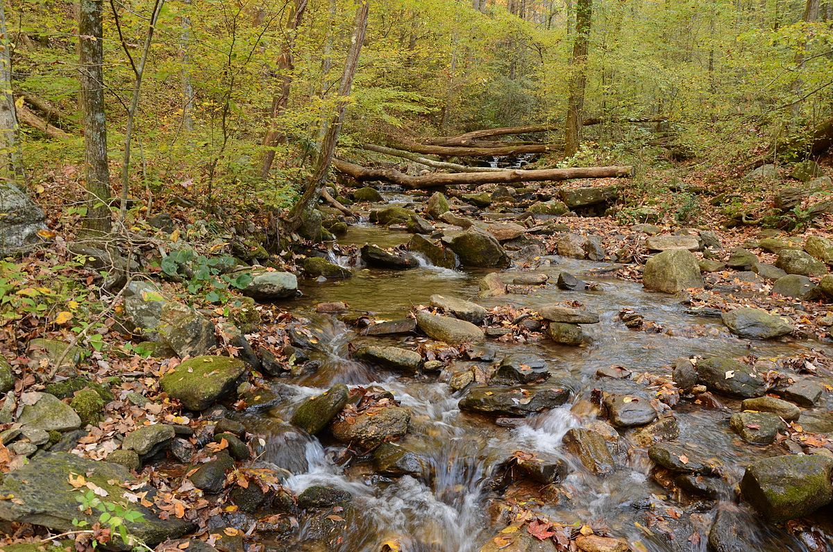
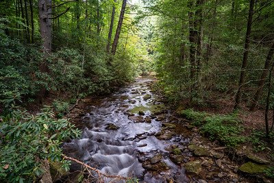
<p><strong>Damage to West Wildcat Road does not allow safe vehicle access to the campgrounds.</strong></p><p><strong>Wildcat 2 Campground is closed. </strong></p><p>Wildcat Road has sustained 4 slides in recent years (with the first slide happening in 2019). Due to the risk of additional slides, the road has been closed in the interest of public safety. Funding from the U.S. Department of Transportation’s <a href="https://gcc02.safelinks.protection.outlook.com/?url=https%3A%2F%2Fhighways.dot.gov%2Ffederal-lands%2Fprograms%2Ferfo&data=05%7C01%7C%7C193b0c343c34400c93b408db99c40067%7Ced5b36e701ee4ebc867ee03cfa0d4697%7C0%7C0%7C638272839318575798%7CUnknown%7CTWFpbGZsb3d8eyJWIjoiMC4wLjAwMDAiLCJQIjoiV2luMzIiLCJBTiI6Ik1haWwiLCJXVCI6Mn0%3D%7C3000%7C%7C%7C&sdata=zSt3mNZ1xEYeUB0EXBtEE86GStg0P0qbZ1LsKMyQAPs%3D&reserved=0">Emergency Relief on Federally Owned R</a>oads program has been submitted for all 4 slides. Since then, slide 1 has been repaired with slides 2-4 remaining.</p><p> </p><p><strong>It is our goal to have these slides repaired and the road reopened. We appreciate your patience as we work to restore Wildcat Road. </strong></p><p> </p><p>Please see photographs of the landslides and recent repairs to slide 1: <a href="https://gcc02.safelinks.protection.outlook.com/?url=https%3A%2F%2Fflic.kr%2Fs%2FaHBqjAQDh5&data=05%7C01%7C%7C193b0c343c34400c93b408db99c40067%7Ced5b36e701ee4ebc867ee03cfa0d4697%7C0%7C0%7C638272839318575798%7CUnknown%7CTWFpbGZsb3d8eyJWIjoiMC4wLjAwMDAiLCJQIjoiV2luMzIiLCJBTiI6Ik1haWwiLCJXVCI6Mn0%3D%7C3000%7C%7C%7C&sdata=Oo3QhUpJn0xL8IqyHk7wFYFd%2BFK%2F6WuNj6MPpI8%2BVXw%3D&reserved=0">https://flic.kr/s/aHBqjAQDh5</a></p><p> </p><p> </p><p>Although the winding road leading to the campground is not trailer or RV-friendly, the payoff of landing a night in this environment is pure delight. These developed tent camping-only campgrounds are buried deep in the North Georgia Mountains west of Lake Burton and along the headwaters of Wildcat Creek. The creek, seasonally stocked with rainbow trout, runs directly adjacent to the campsites and provides an astounding setting, so be prepared to capture nature at its best, and bring your camera. On clear nights the stars appear to be just an arm’s reach away! <br /> </p>
About the campground
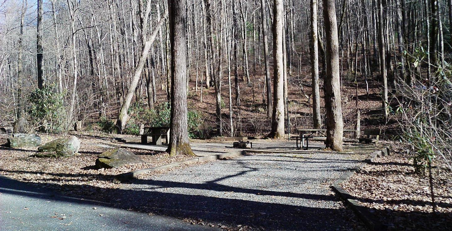
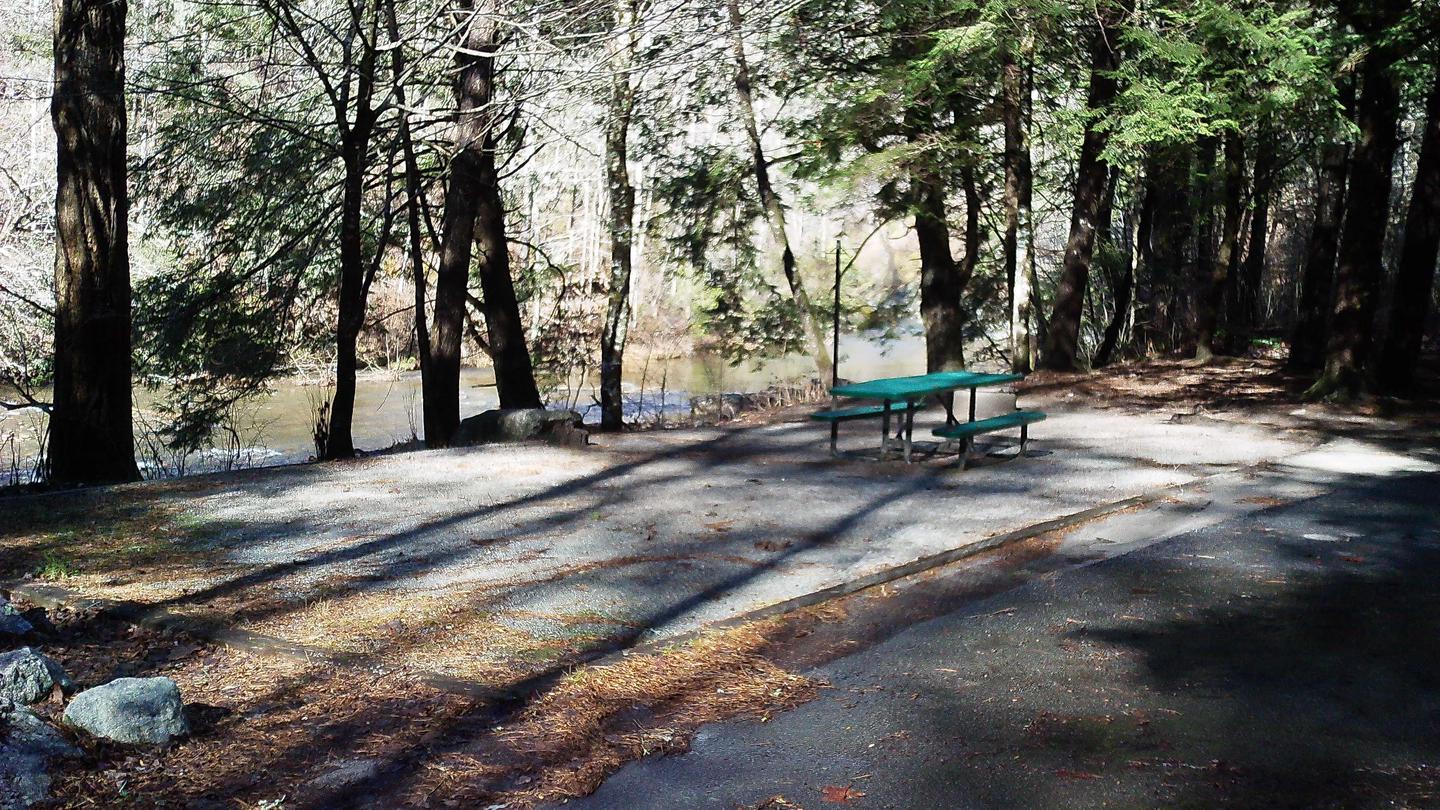
The elevation is 2,720 ft. The campground is very rustic and is adjacent to Wildcat Creek. Sites are close together.
Seasons & access
Parking aprons are gravel. Facilities Flush Toilets: No Hot Showers: No Vaults: Yes Wheelchair Friendly Toilets: No Public Phone: No Playground: No No. Water Spigots (non-site): 0 Water Sports Wading is possible in Wildcat Creek. Hiking: No Fishing: Stocked Rainbow trout Helton Creek Falls, near Boggs Creek campground - Chattahoochee National Forest (GA) Cherokee National Forest 95 Cherokee National Forest Tennessee The Cherokee National Forest, located in northeastern Tennessee and western North Carolina, is comprised of 631,715 acres. Three hundred and twenty-seven acres are located in North Carolina. The Forest borders the Great Smokey National Park on the northern and southern ends. There are 31 developed campgrounds, 19 of which meet the selection criteria. The Cherokee National Forest stretches along the eastern edge of Tennessee like a towering hedge of lush green vegetation. Rich in cultural heritage and natural beauty, the Cherokee National Forest provides wide and diverse recreation opportunities to its visitors. The Ocoee River, in the southernmost portion of the Cherokee, was the site for the 1996 Olympic Whitewater Competitions. However, the Cherokee National Forest is laced with whitewater rivers for the kayaker of any experience level. Some of these rivers have commercial outfitters that will provide equipment and guides if needed. Other rivers are classified "non-commercial" and visitors must bring their own equipment. (Check with a Ranger District Office for more information about outfitters and water levels.) Fast flowing rivers mean Rainbow trout. Many of the streams and rivers are stocked regularly for the angler's pleasure. Brook and Brown trout can also be found in the Cherokee's streams and rivers. bass, Bluegill, and Crappie are plentiful in the many lakes found within the Cherokee. These lakes also offer a wide variety of water activities such as wind sailing, water skiing, and boating. The most popular recreation activities found in the Cherokee National Forest probably are camping and hiking. For the "serious" hiker there is the Appalachian Trail (AT) which traverses the length of the Cherokee. The 20-mile John Muir Recreation Trail follows the route said to have been taken by the Sierra Club founder during his travels from Kentucky to Florida. For the more "leisurely" hiker, there are a number of shorter hikes to waterfalls, along interpretive nature trails and through tranquil woods. Along with the various levels of hiking trails, there are a number of horse trails (from the 22-mile Starr Mountain to a 1.5-mile trail named Chestnut Mountain), mountain bike, dirt bike, and 4WD trails. No matter which trail the visitor enjoys, it is possible they will see or meet one of the 70 mammals or 262 species of birds that make the Cherokee National Forest their home. Spotting one of the many types of wildflowers adds interest and pleasure to hiking in a Forest with its diverse topography and vegetation. The locations and level of development found in the Cherokee's many campgrounds can meet the needs of any camper. Thunder Rock campground, adjacent to the Ocoee River, is designed for campers who enjoy a rustic, communal environment and is well suited for kayakers. For a quiet setting and good Rainbow trout fishing, Paint Creek campground is the place. Indian Boundary is an excellent campground for the whole family. From Loop B's electric hook-ups and modern bathrooms to the least developed, rustic sites of Loop C, large swimming area, various bicycle/foot trails, and lake fishing, this campground is a great vacation spot. The Cherokee has only one cabin it rents out - The Historic Donley Cabin. The authentic two-room, 19th century log cabin was the home of Jack Donley (1846-1941). Reservations are needed to experience firsthand the life in these Appalachian mountains. Around 1823, gold was discovered in the southern portion of what is now the Cherokee National Forest. A drive over to Coker Creek Village for a lesson in panning for gold and you will be ready to practice your skills in a Forest stream. If your cultural interests are more "civilized," there are towns like Greeneville (Davy Crockett's birthplace), Andrew Johnson National Historical Site, Tusculum College, and other points of interests that await your exploration. Cherokee National Forest 96 The Cherokee National Forest, with its nine whitewater rivers, mysterious grassy balds, battle- scarred lands, and lush, vibrant forests, offers diverse recreation opportunities that will keep one busy time after time. Hiking the AT, biking around Indian Boundary Lake, fishing for that "big one," mastering whitewater, or simply enjoying the quiet and solitude of the forest, Cherokee National Forest awaits you. Forest Supervisor's Office 2800 North Ocoee St. NW Cleveland, Tennessee 37312 423-476-9700 Ranger District Offices Nolichucky/Unaka District 4900 Asheville Hwy. SR 70 Greeneville, Tennessee 37743 423-638-4109 Ocoee/Hiwassee District 3171 Highway 64 Benton, Tennessee 37307 423-338-5201 Tellico District 250 Ranger Station Rd. Tellico Plains, Tennessee 37385 423-253-8400 Watauga District 4400 Unicoi Dr. Unicoi, Tennessee 37692 423-735-1500 Go to www.forestcamping.com for the latest updates. Cherokee National Forest 97 Long expanses of grassy highlands, called Grassy Balds, are in stark contrast to the surrounding thick woods. The origin of these unique and attractive features of nature have long been debated. Are they natural or were they the product of humans? Or is there another reason for their existence? Whatever the answer may be, Balds provide a unique opportunity for hiking as well as viewing wildlife and the Cherokee’s many magnificent sights. Cherokee National Forest 98 Campground Map - Northern Section No. Campground Page No. Campground Page 1 Backbone Rock 102 6 Rock Creek 120 2 Jacobs Creek 112 7 Horse Creek 109 3 Little Oak 113 8 Old Forge 117 4 Cardens Bluff 104 9 Paint Creek 118 5 Dennis Cove 107 10 Round Mountain 122 Cherokee National Forest 99 Cherokee National Forest (Northern Section) Quick Look-Up Table - Campground Locations and Descriptions STATE NEAREST CITY/TOWN CAMPGROUND TOTAL SITES PAGE NO. Tennessee Bristol Jacobs Creek 27 112 Bristol Little Oak 70 113 Del Rio Round Mountain 16 122 Erwin Rock Creek 34 120 Greeneville Paint Creek 21 118 Greeneville Horse Creek 15 109 Greeneville Old Forge 10 117 Hampton Dennis Cove 16 107 Hampton Cardens Bluff 42 104 Shady Valley Backbone Rock 11 102 Cherokee National Forest 100 Campground Map - Southern Section No. Campground Page No. Campground Page 2 North River 115 6 Lost Creek 114 3 Big Oak Cove 103 7 Chilhowee 105 4 Spivey Cove 123 8 Parksville Lake 119 5 Holly Flats 108 9 Thunder Rock 124 Cherokee National Forest 101 Cherokee National Forest (Southern Section) Quick Look-Up Table - Campground Locations and Descriptions STATE NEAREST CITY/TOWN CAMPGROUND TOTAL SITES PAGE NO. Tennessee Cleveland Chilhowee 82 105 Ducktown Parksville Lake 16 119 Ducktown Thunder Rock 42 124 Reliance Lost Creek 15 114 Tellico Plains Big Oak Cove 11 103 Tellico Plains Indian Boundary 88 110 Tellico Plains North River 10 115 Tellico Plains Holly Flats 17 108 Tellico Plains Spivey Cove 14 123 Cherokee National Forest 102 Cherokee National Forest - Campground Descriptions
RV information
Parking aprons are gravel.
Directions
From Clayton, GA, take U.S. Rt. 76 west 9.7 miles to State Rt. 197. Turn left onto Rt. 197 and go 5.1 miles to Wildcat Rd. (Forest Rt. 26). Turn right onto Wildcat Rd. and go 4.4 miles to campground. NOTE: Wildcat Rd. is gravel, steep (in places), single lane with turnouts. There are minimal potholes and washboards.
- National Forest
- Chattahoochee National Forest
- Ranger District
- Chattooga River
- Elevation
- 2720
- Rate
- $10 per day
- Maximum Stay
- 21