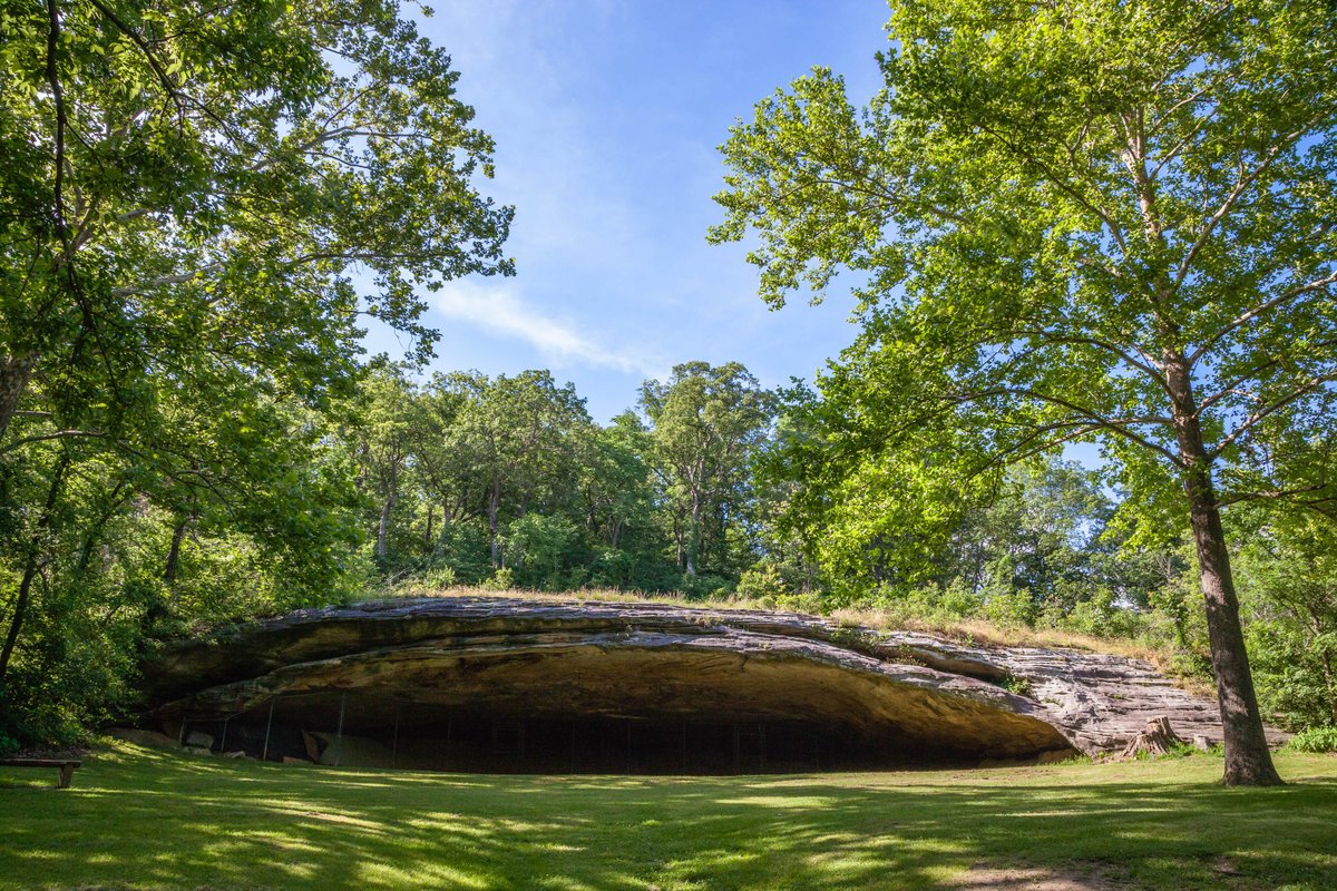
Tucked into 386 wooded acres along the Loutre River, Graham Cave State Park's campground offers something truly special: a chance to sleep beneath the same stars that flickered over ancient peoples who sheltered in the cave 10,000 years ago. With short, easy trails connecting you to this nationally significant archaeological site and quiet river overlooks, it's an ideal basecamp for families seeking both natural beauty and a tangible connection to Missouri's deep past.
The campground contains a mix of electric and non‑electric campsites, including drive‑in RV/tent sites and walk‑in tent sites. Sites are wooded and shaded by mature trees.
Graham Cave is an archaeologically significant rock shelter where excavations revealed human occupation dating roughly 8,000–10,000 years ago (Dalton and Archaic periods). Interpretive exhibits and trail signage explain the prehistoric use of the cave and the area's cultural importance. Weather and SeasonsPlan your visit between April and October to enjoy the full amenities of restrooms and showers during the park's primary season. Spring arrivals are rewarded with wildflowers and comfortable hiking temperatures, while fall brings brilliant foliage and crisp air perfect for exploring the trails. Summer visits mean lush greenery but also heat, humidity, and the inevitable Missouri mosquitoes—bring bug spray. If you're the adventurous type who doesn't mind fewer comforts, off-season camping offers near-total solitude and a more rugged experience, though you'll need to plan accordingly for reduced facilities.
Weather data by Open-Meteo.com, licensed under CC BY 4.0, processed by Outdoorithm.
Natural Features and SceneryYour morning coffee tastes better when deer are browsing nearby and wild turkeys are calling from the oak-hickory forest. The campground sits amid rolling, wooded terrain where ravines cut through the landscape and small streams trickle toward the Loutre River. A short hike brings you to the dramatic sandstone overhang of Graham Cave itself, while other trails wind through the Graham Cave Glades Natural Area, where openings in the forest reveal sun-drenched glades buzzing with life. Birdsong fills the canopy throughout the seasons, and river valley overlooks offer peaceful spots to simply sit and watch the landscape breathe.
Geological RegionGraham Cave Glades Natural Area within the Loutre River valley; features sandstone cave/overhang, forested glades and oak-hickory woodlands.
Scenic ViewsViews are primarily forested: wooded campsites, ravines and occasional overlooks of the Loutre River valley; the dramatic sandstone overhang of Graham Cave is a focal point on nearby trails.
 4.07
4.07