Go if
Hikers targeting Laramie Peak will find the Connector Trail leaving right from camp, with walk-in sites spaced far enough apart for real solitude. Midweek summer visits are the sweet spot before July and August weekends fill all 11 spots.
 4.1927 reviews
Price
$20/night
Booking
Check Site
Sites
11 campsites
Season
Year-round
Cell
Unknown
Pets
Check Policy
Elevation by Open-Meteo.com, licensed under CC BY 4.0, processed by Outdoorithm.
Price
$20/night
Booking
Check Site
Sites
11 campsites
Season
Year-round
Cell
Unknown
Pets
Check Policy
Elevation by Open-Meteo.com, licensed under CC BY 4.0, processed by Outdoorithm.
We'll monitor this campground and alert you the moment sites become available.
Free to start · paid plans add 2-min scans
263,000+ sites monitored · Email alerts to start; SMS and in-app with an account
Learn more about alerts →Friend Park Campground
42.2561, -105.4848
We'll monitor this campground and alert you the moment sites become available.
Free to start · paid plans add 2-min scans
263,000+ sites monitored · Email alerts to start; SMS and in-app with an account
Learn more about alerts →Hikers targeting Laramie Peak will find the Connector Trail leaving right from camp, with walk-in sites spaced far enough apart for real solitude. Midweek summer visits are the sweet spot before July and August weekends fill all 11 spots.
ATV traffic has turned at least some weekends noisy according to recent reviews, and the vault toilets can run out of supplies. Bring your own TP, call ahead on water status, and AWD is strongly recommended for the long gravel approach.
Reference information about Friend Park Campground sourced from official USFS records and forestcamping.com. View official recreation.gov page →
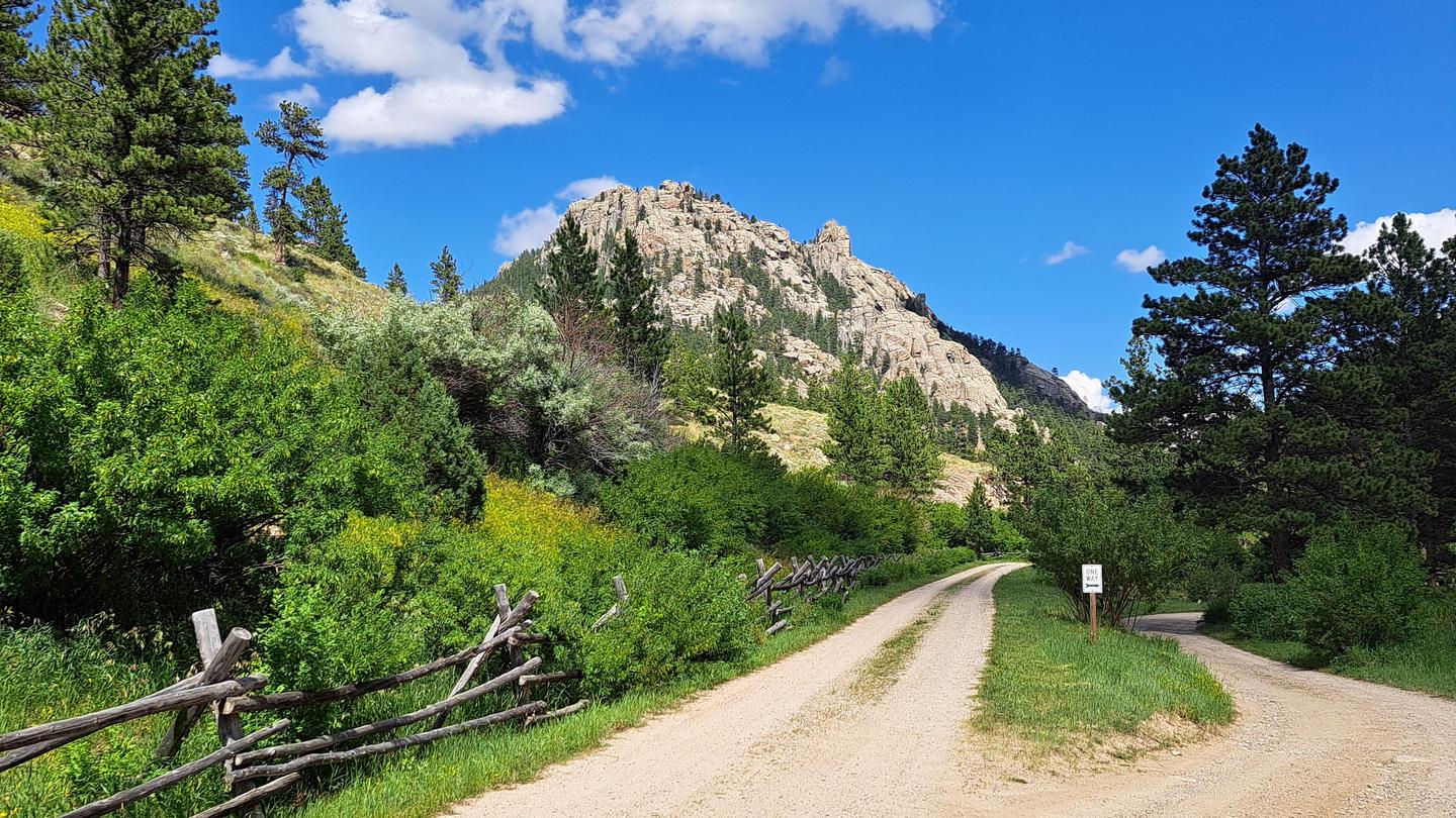
<p><strong>***There will be construction on Bear Creek Road from Esterbrook Road to the Bear Creek Crossing, starting on 7/17/24 for at least 30 days. Expect heavy truck and equipment traffic.***</strong></p><p>Friend Park is set at the base of Laramie Peak, which is the tallest peak in the North Laramie Range and was a waypoint for Oregon Trail immigrants. At 7400 feet in elevation, there are 11 campsites, including 3 that are walk-in access/tent use only, and 2 vault toilets. The campground has trail access to both the Laramie Peak Trail and Friend Park Trail for non-motorized users.</p><p>Motorized users of the Laramie Peak Trail will find the trailhead just 1/4 mile from the campground and please be aware Friend Park Trail is NOT open to motorized use. Fishing is available in the adjacent Friend Creek and surrounding beaver ponds.</p><div class="usa-alert usa-alert--info usa-alert--slim"><div class="usa-alert__body"><p class="usa-alert__text">This site was approved for a fee change - <a class="usa-link" href="https://www.fs.usda.gov/detail/mbr/fire/?cid=FSEPRD1092198">Click here for more information</a></p></div></div>
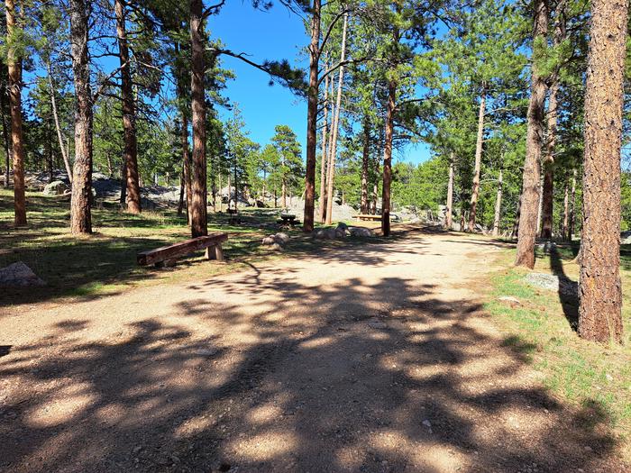
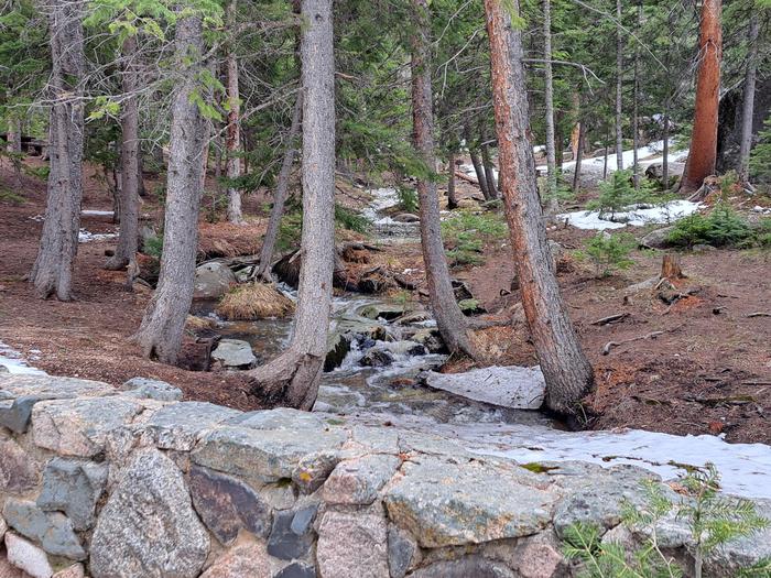
The elevation is 7,400 ft. The campground is located above Friend Creek at the base of Laramie and Friend Peaks. Laramie Peak, at 10,200 ft., is the highest peak in the Laramie Range and was a landmark for pioneers using the Morman and Oregon Trails. The campground is delightful for tents and small RVs (pop-up and slide-in styles). There are several nice rock climbing formations nearby. Sites are fairly close together and shaded by firs and pines. The campground is a good location for wildlife viewing - wild turkey and bighorn sheep.
Open June 1 through Labor Day
The water spigot is a hand pump.
The parking aprons are gravel. Travel trailers are not recommended; there is no turnaround.
In Douglas, WY, take State Rt. 94 (from Exit 140 of Interstate 25) 16.4 miles to a "Y" intersection (County Rt. 5/Esterbrook Rd.). Bear left onto County Rt. 5/Esterbrook Rd. (dirt) and go 10.8 miles to the Esterbrook Work Center at a "Y" intersection. Bear right, staying on County Rt. 5, and go 15.3 miles to still another intersection (Forest Rt. 671/Bear Creek Rd.). Bear left onto Forest Rt. 671/Bear Creek Rd. (steep with single-lane sections) and go 2.7 miles to campground sign. Turn left at sign and go 1 mile to campground. NOTE: County Rt. 5 becomes rather rough and rocky. At 3.6 miles on Rt. 5, an unmarked "Y" intersection appears. Bearing either left or right takes the driver to the same place on Rt. 5.
Context for the broader area surrounding Friend Park Campground, sourced from the federal Recreation.gov rec-area record.
<p>Welcome to Medicine Bow-Routt National Forests and Thunder Basin National Grassland! Visitor opportunities abound on almost 2.9 million acres of National Forest System lands.</p> <p>The Medicine Bow and Routt National Forests provide year-round recreation opportunities for you. These activities include hiking, biking, camping, horseriding, OHV riding, fishing and hunting, just to name a few. Beautiful vistas await sightseers and photographers.</p> <p>The topography varies greatly within the national forests. Elevation ranges from 5,500 to 12,940 feet. The climate ranges from semi-arid at low elevations to colder and less arid in the high country. Frost may occur at any time, and visitors to the higher elevations should be prepared for harsh weather, including snow and high winds, even during the summer months.</p> <p>The Thunder Basin National Grassland provides unique opportunities for recreation, including hiking, sightseeing, hunting, and fishing. There are no developed campgrounds; however, dispersed camping is allowed. Elevation on the national grassland ranges from 3,600 to 5,200 feet, and the climate is semi-arid.</p> <p><strong><strong>The following recreation conditions report includes a sampling of our recreation sites. For information on specific sites or areas, use the link to the right or search by activity in the lefthand search bar. </strong></strong></p>

Availability, what to pack, similar spots — ask anything and get an instant answer.
Best season: summer. Summer offers the most reliable access and the fullest range of activities — expect daytime highs in the mid-60s to mid-70s°F (≈18–24°C) and cool nights in the 30s–40s°F (≈0–9°C). Trails are snow-free, meadows are at peak wildflower display, and streams and high-country lakes fish well after ice-out; mountain biking and long ridge hikes are at their best. Weekends in July–August can be busy (Friend Park has only 11 sites), so plan midweek visits for solitude; potable water is typically available Peak months: July, August, September, June Avoid: December, January, February
Aspen color, cooler temps and season extending into November make fall attractive.
Weather data by Open-Meteo.com, licensed under CC BY 4.0, processed by Outdoorithm.
Potable water is typically available in this campground from early June to late November. These dates may vary due to weather. Potable water availability may vary due to well and/or pump maintenance, and water testing requirements. As such, we encourage you to bring your own drinking water or call ahead.
Researching this campground? Ask anything — other campers and our team will weigh in. No visit required.
Short heads-ups about the road in, gear quirks, and timing, compiled by Outdoorithm from public reviews and operator information.
Rate Friend Park Campground
Been here? Tap a star to start. Takes about a minute.
Sign-in required only if you want your name on it.

Be the first to review this campground
Every adventure creates another. Share what you learned so the next camper feels a little more prepared heading out.