Nestled along the shores of a sprawling 3,330-acre reservoir, Alum Creek Group Camp welcomes campers with everything from electric and full-hookup sites to cozy rental cabins and dedicated equestrian facilities. This well-appointed campground requires reservations and rolls out the welcome mat for your four-legged companions, while treating guests to modern comforts like heated showers, flush toilets, and exclusive beach and boat ramp access. Whether you're planning a group gathering, a family getaway, or a horseback riding adventure, you'll find all the amenities you need for a memorable outdoor experience.
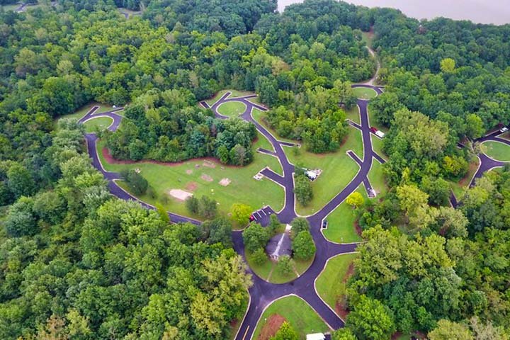
Large campground with electric sites and full-service (electric, sewer, water) sites; camper cabin and Sherman cabins; a primitive equestrian camp; and a group camp area.
Historical Significance
The family campgrounds feature a bronze plaque commemorating the Fort Cheshire blockhouse. The area near the park historically included a mid-1800s community known as the Community of Africa.Weather and SeasonsPlan your cabin getaway anytime from April through December, when these cozy retreats provide a comfortable home base for exploring the park. The campground embraces a quieter rhythm during the off-peak season (November 1 through April 15), when you'll find more availability and a peaceful atmosphere, though some services scale back and certain restroom facilities close for the winter months. This slower season offers its own rewards for those who appreciate solitude and the stark beauty of the off-season landscape.
Weather data by Open-Meteo.com, licensed under CC BY 4.0, processed by Outdoorithm.
Natural Features and SceneryPicture yourself settling into a shaded campsite where dappled sunlight filters through the trees, with options ranging from deeply wooded retreats to sun-kissed clearings that suit every camper's preference. Select sites offer stunning views across Alum Creek Lake's expansive waters, creating postcard-perfect sunrises and sunsets from your own campsite. Equestrian enthusiasts will discover miles of bridle trails winding through the landscape, while registered campers enjoy the exclusive privilege of accessing pristine beaches and launching boats into the lake's calm waters—a private slice of paradise reserved just for overnight guests.
Scenic ViewsSome campsites overlook Alum Creek Lake and many sites are set among trees providing wooded lake views.
 4.21
4.21