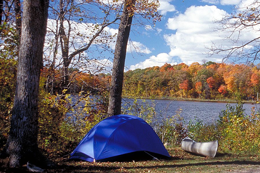
Coneflower Group Campground

Star0
0 review
565 155th Street South Glyndon, MN 56547
Top 13% in MNSpring

Quick Facts

968 ft

Price

Varies

Booking

Reservable

Sites

Varies

Season

Year-round

Cell

No Service

Pets

No Pets

Electric
Get Directions

Campground Map

565 155th Street South Glyndon, MN 56547

Coneflower Group Campground

565 155th Street South Glyndon, MN 56547

Nearby places
Fargo–Moorhead ~14 miles

Weather at Coneflower Group Campground


About Coneflower Group Campground


RV details

Electric hookups25 of 38 sites (66%)

Planning your trip?Check out our camping packing checklist


Coneflower Group Campground
No fees available
Campsite Fees
A non-refundable reservation fee is charged for each advance reservation ($10 by phone / $8 online). Specific campsite nightly fees are not listed on...
Show more
No paid fee categories listed.

Get Notified When Available

We'll monitor this campground and alert you the moment sites become available.

Free to start · paid plans add 2-min scans

256,000+ sites monitored · Email alerts to start; SMS and in-app with an account

Learn more about alerts →
Share this campground
Minnesota State Parks
Provider
218-498-2124

Go if

Groups who want a structured nature experience in summer: the swimming area on the Buffalo River, bobolinks and greater prairie chickens in the grassland, and trail access to one of Minnesota's largest remnant tallgrass prairies are all within easy reach of camp.

Skip if

No toilets, no potable water, no showers, and no dump station make this a tough sell for groups expecting basic comfort infrastructure. Pets aren't allowed, and the non-refundable reservation fee adds risk if plans change.


Campgrounds
Buffalo River State Park
Coneflower Group Campground

About Lake Lowell

Context for the broader area surrounding Coneflower Group Campground, sourced from the federal Recreation.gov rec-area record.

Lake Lowell is managed by both the Bureau of Reclamation and the US Fish and Wildlife Service. Part of the <A HREF="https://www.usbr.gov/projects/index.php?id=338">Boise Project</a> this 14.5 square mile (9,800-acre) reservoir with 28 miles of shoreline lies within the <A HREF="http://deerflat.fws.gov">Deer Flat National Wildlife Refuge</a>. Boating, fishing, and wildlife viewing are the major recreation activities at Lake Lowell, located 5 miles southwest of Nampa. Lake Lowell, originally called Deer Flat Reservoir, was the first storage reservoir completed for the Boise Project, one of the earliest Reclamation projects. Historic features include the embankment dams which are on the National Register of Historic Places. The embankments include the headworks for four canals. Repairs made to the dams in 1938-39 by the Civilian Conservation Corps include rustic lava-rock parapet walls with decorative designs embedded in them. Lake Lowell is a great birding spot with over 200 recorded avian species. Spectacular bird concentrations occur on the lake during peak migration periods. During state seasons, upland birds, ducks, coots, and mourning doves may be hunted on the East Side and South Side Recreation Areas. Available fish species include rainbow trout, largemouth bass, smallmouth bass, crappie, yellow perch, bluegill, and bullhead and channel catfish. Season open year-round. Reservoir acre feet and total reservoir capacity and cubic feet/second release rates for rivers below <A HREF="https://www.usbr.gov/pn/hydromet/boipaytea.html">Boise & Payette River Basins</a> reservoirs and select river locations are updated daily and graphically provided. Power craft permitted April 15 through October 1. Site offers boat ramps and docks, and parking at the upper and lower dam sites and at the visitor center. The refuge Visitor Center is open all year on Monday through Friday from 8am to 4pm and Saturdays from 9am to 4pm. For additional information, please see the <A HREF="http://deerflat.fws.gov"> Deer Flat National Wildlife Refuge</a> or <a href="http://www.usbr.gov/pn/hydromet/ramps/lowell/lowell.html"> The Bureau of Reclamation's information on Lake Lowell</a>.

Directions

Directions: Take Exit 35 off of Interstate 84. Go north 1/2 mile to Karcher Road. Turn left and go west 3 miles to Lake Avenue. Turn left and go south 3 miles to the Upper Dam. Cross the dam to the refuge Visitor Center.

Download area map (PDF)

Explore related camping guides

Coneflower Group Campground appears in our curated guides. Explore more top-rated campgrounds for the same activities and regions.