Great Meadows Campground sits at 1,000 feet elevation in Daniel Boone National Forest, offering 18 primitive sites split between two loops. Sites cost $10-$15 per night on a first-come, first-served basis and can handle RVs up to 35 feet. Rock Creek runs alongside the camping areas, and there's no cell service.
Great Meadows Campground supports primitive camping, including for tents and RVs, but lacks full-service amenities.
Weather and SeasonsFall delivers the best combination of comfortable weather and scenery. Daytime highs run from the mid-40s to mid-60s F, with cool nights in the 30s and 40s. The hardwood canopy turns orange, red, and gold from mid-September through mid-October. Rock Creek runs clear and cool, and crowds stay lighter than summer weekends. Spring temperatures range from the upper 30s to mid-60s. Summer warms into the 80s but brings large horseflies. Mountain weather can shift quickly, and flash floods are possible during heavy rain.
ElevationPerched at 1,000 feet above sea level, Great Meadows enjoys the refreshing mountain air that keeps spring and fall temperatures delightfully cool, creating ideal conditions for campfire gatherings and comfortable sleeping under the stars.
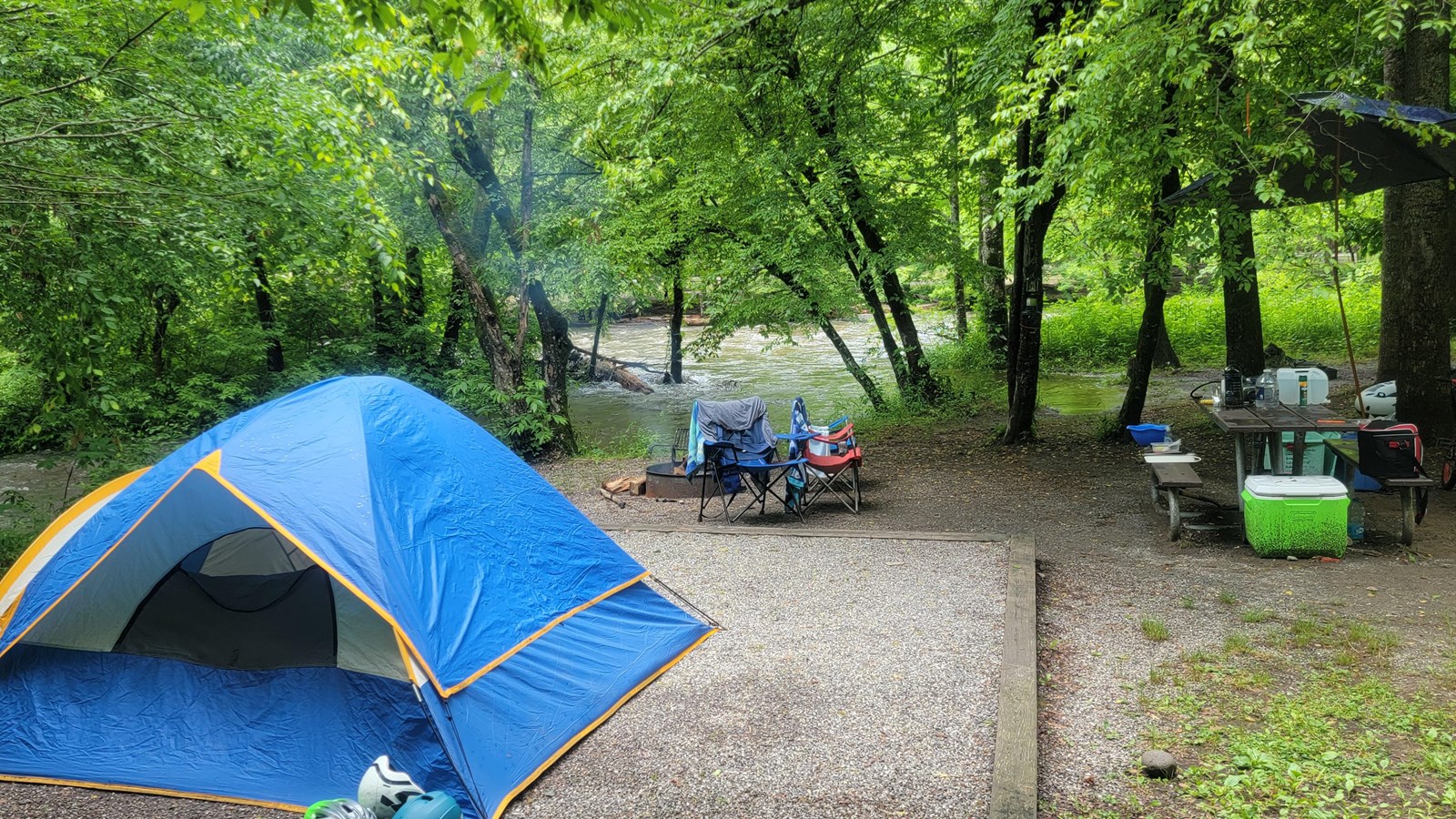
Natural Features and SceneryMixed hardwoods, hemlocks, shortleaf pines, and oaks create a layered forest canopy across the campground. Rock Creek flows adjacent to the sites, clear enough for fishing and wading. The creek has carved this landscape over time, and the surrounding Daniel Boone National Forest extends the wilderness in all directions. Deer Loop has more vegetation and shade, while Raccoon Loop is more open along the creekside.
Geological RegionNestled within the vast Daniel Boone National Forest, Great Meadows occupies a special corner of Kentucky's wilderness where ancient geological forces have sculpted a landscape of remarkable diversity. The campground is enveloped by a rich forest ecosystem featuring majestic mixed hardwoods, fragrant hemlock groves, resilient shortleaf pines, and mighty oaks that have stood sentinel for generations. Rock Creek, carving its path adjacent to the camping areas, serves as a liquid lifeline through this verdant wilderness, its waters having shaped the land over countless millennia.
Scenic ViewsRaccoon Loop offers views of Rock Creek, while Deer Loop provides ample shade and a woodland atmosphere. User reviews highlight stargazing opportunities due to minimal light pollution.
Lodging & AccommodationsNo hotel-style lodging accommodations are available within this campground.
Programs & ActivitiesNo information on cultural or educational programs is provided.